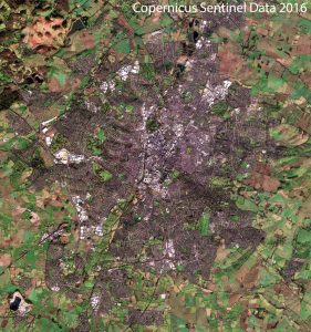
New satellite imagery gives unique view of Leicestershire in all its glory

Scientists within the atmospheric composition group have recently released images of Leicester from the Sentinel 2a satellite instrument to highlight the quality of the data and describe its applications for atmospheric science. Read the full article and download the images here:
http://www2.le.ac.uk/offices/press/press-releases/2017/january/new-satellite-imagery-gives-unique-view-of-leicestershire-in-all-its-glory
The image was produced by Dr David Moore from the National Centre for Earth Observation (NCEO), based in the Leicester Institute for Space and Earth Observation, as a test of new software that has been developed to make use of the data from Sentinel-2.
Dr Moore said: “We have a system in the Earth Observation Science Group that collects data in almost near-real time and I connect with other users of the system on dedicated forums to discuss and share software and new data developments.”